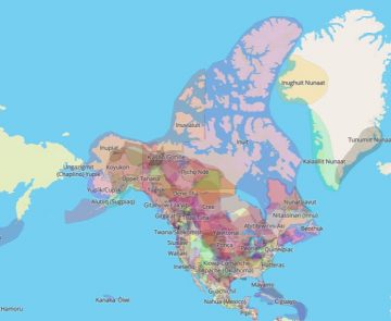
Native Land is an online, interactive map that maps out the ancestral lands of Indigenous peoples all over the world, specifically in the Americas, Northern Europe and Austronesia. Its “About” page states that it was created in 2015 by a non-Indigenous man named from the Okanagan named Victor Temprano. Right now, Native Land is run by a team of Indigenous and non-Indigenous people from around Canada and around the world.

There is incredible diversity amongst Indigenous populations and, unfortunately, this diversity can often get overlooked. Native Land is a valuable resource that can help expose students to the heterogeneity of Indigenous populations, both nationally and internationally. Teachers might use Native land to recognize the territories on which their own school resides, or when learning about other places in the wold so that they incorporate more local voices and resources in their teaching.

- Go to native-land.ca
- Use the interactive map to view the locations of the ancestral lands of various Indigenous groups from around the world
- Search the lands by Territories, Languages and/or Treaties


