
Decolonizing Teaching Indigenizing Learning has digitally gathered Curriculum Bundles designed by Indigenous educators
The Decolonizing Teaching Indigenizing Learning website supports teacher candidates, in-service teachers, and faculty as they move towards implementing Indigenous education and pedagogies into their curricula. The website centres on Indigenous pedagogies and values Indigenous knowledges as fluid and interconnected. Decolonizing Teaching Indigenizing Learning was made possible by many hands, minds, and hearts. The content and […]

Decolonizing maps is a process that addresses the biases, inaccuracies, and colonial perspectives inherent in many cartographic representations.
Maps have historically been used as powerful tools of colonization, often reinforcing Eurocentric worldviews, territorial claims, and narratives that marginalize Indigenous cultures and perspectives. Eurocentric maps often omit or misrepresent Indigenous territories, place names, and cultural landmarks. Decolonizing maps refers to a process that challenges and revises traditional maps to address the biases, inaccuracies, and […]
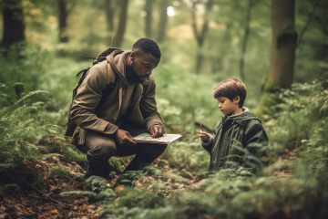
Species ID: whose names are these?
Engaging in species identification and classification is a common and, many would argue, necessary aspect of science education. There are many tools, digital and analogue to assist us as we explore and learn about the world around us. In a recent collaboration with the Education Library, we showcased a few resources and approaches to support […]
